4 April 2026
process & updates

Written by:
Jonathan Elmore
Just Because Your Land is Beautiful, Doesn't Mean You Can or Want to Build on It.
Buying a piece of land in the Fort Smith area and falling in love with it is one thing. Knowing whether — and how — you can actually build on it is another conversation entirely.
That's not a warning meant to discourage you. It's just the reality of how land works. A parcel might have a stunning ridge view, back up to a creek, or sit in a neighborhood you've always wanted to be in, and still come with conditions that completely change how your project gets designed and what it costs to build. The earlier you understand those conditions, the better every decision that follows will be.
This is what a site analysis is for — and it's one of the first things we do before design begins.
What we're actually looking at.
A site analysis isn't a single checklist item. It's a layered process that combines desktop research — pulling maps, zoning records, utility data, flood information — with actual time spent on the property at different times of day, observing how the site behaves in the real world. All of that gets synthesized into a clear picture of what the land is telling us before we ever put a building on it.
Here's what we're evaluating:
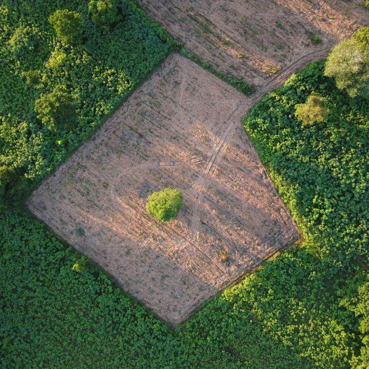
The ground itself. Topography, slopes, drainage patterns, soil conditions — these determine what kind of foundation your project needs, how much grading will be required, and where water moves when it rains. In parts of Sebastian and Crawford Counties, soil conditions and elevation changes can significantly affect construction costs. We'd rather know that before you've committed to a design.
What's already there. Existing trees (including any under city protection), rock outcroppings, wetlands, floodplain boundaries, and natural features all factor into where a building can sit and what clearing or disturbance the project will involve. Fort Smith's proximity to the Arkansas River means flood zone mapping is something we take seriously on every site near lower elevations.
Sun, wind, and climate. Where the sun rises and sets relative to your property, which direction the prevailing winds come from, and how the seasons affect the microclimate on your specific lot all directly influence how we orient a building for comfort, energy efficiency, and daylighting. A home that's oriented well to the Arkansas sun performs better and costs less to operate year over year.
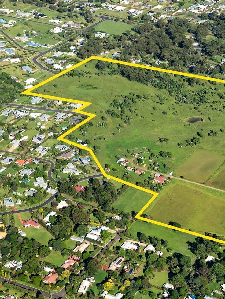
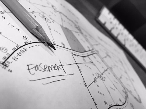
The legal picture. Zoning classification, permitted uses, setback requirements, building height limits, lot coverage maximums, easements, rights-of-way, deed restrictions, and required permits — all of this lives in public records, but it takes time to pull and understand correctly. We review it thoroughly so there are no surprises when it's time to submit for permits with the City of Fort Smith or Sebastian County.
Utilities and access. Where water, sewer, electrical, gas, and telecommunications lines exist relative to your property — and how far a connection might need to run — has a direct impact on your budget. The same goes for road access and parking. We map what's there and flag anything that could drive costs up before the project gets priced.
The neighborhood context. How your building will relate to adjacent properties, what the surrounding character of the area looks and feels like, noise sources, traffic patterns, and the broader community all shape what a good design response looks like. A home built on a quiet infill lot in Fort Smith's established neighborhoods should feel different than one built on a rural acreage outside Greenwood — and our design process reflects that.
Sustainability and long-term opportunity. We also look for what the site naturally offers — solar exposure, prevailing breezes, natural drainage — that can be leveraged to make your project more efficient and more resilient over time.
Why skipping this step is expensive.
We've seen what happens when a site analysis gets rushed or skipped altogether. A foundation design gets changed mid-project because no one looked at the soil reports. A setback gets missed and the building footprint has to shrink. A utility extension runs twice as long as budgeted because no one mapped the lines in advance. These aren't hypothetical — they're real problems that cost real money and cause real delays.
A thorough site analysis at the beginning of a project is one of the most cost-effective investments you can make. It turns a parcel of land from an unknown into a known — and gives the design something solid to respond to.
We work with licensed surveyors, geotechnical engineers, environmental consultants, and civil engineers when a project calls for it. The analysis doesn't happen in a vacuum, and neither does the design that follows.
If you've got land in Fort Smith, Van Buren, Greenwood, Alma, or anywhere in the River Valley and you're trying to figure out what's actually possible on it — that's exactly the kind of conversation we're built for. Reach out and let's take a look together.
Design Intelligence Studio is a full-service architectural design firm serving Fort Smith, Arkansas and the River Valley region. We specialize in design consultations, 3D architectural visualizations, construction drawing sets, and community-focused design work.